Canadian Rockies - July/August 2016
This trip report is long time overdue. If not happened that I am between jobs now, I probably won’t have time to write it at all. Nevertheless, I hope it still will be useful, because the available information about Canadian Rockies is somewhat scarce. I found that myself when was doing a research before our trip. There are good guidebooks available, but routes conditions described in them are often outdated. So this is my humble attempt to fill some gaps.
We went to Canadian Rockies in the end of July 2016 with the intention to do some moderate to intermediate classic routes. We stayed 1-st week in Lake Louise campground and the 2-nd week in Wapiti campground near Jasper. Here I describe 3 climbs that we did:
Mount Victoria - Southeast Ridge. 07/25/2016
We climbed mount Victoria from Lake O’Hara side. The plan was to stay in ACC (Alpine Club of Canada) Abbot Pass Hut and climb both Mount Victoria and Mount Lefroy. I booked Abbot Pass Hut long time in advance. The place is very popular and it is often fully booked closer to the climbing season, especially for weekend days. I restored my ACC membership especially for this, because ACC members can book the hut earlier than non-member climbers. With the hut we also booked a bus to Lake O’Hara. Same thing with the bus – it is hard to book it when it is open to general public.
We left our cars at the Lake O’Hara parking lot and loaded to the bus. We were the only one climbing group on a bus, the rest were hikers. We started our approach hike from Lake O’Hara to Abbot Pass under light drizzle. At Lake Oesa the hiking trail ends and the scrambling trail is clearly visible on the Norths Side of the lake. We stopped to make pictures, but mosquitos were violent and we had to move to run from them.
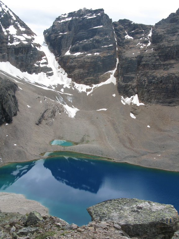
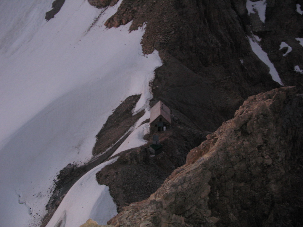
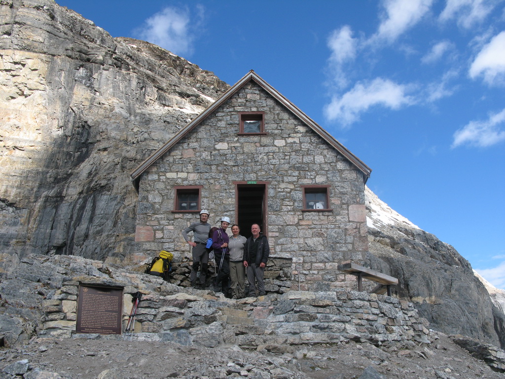
There is a junction in the beginning of the scrambling trail. The left fork goes to Wiwaxy Gap and the right fork goes to Abbot Pass. After some time we entered loose scree gullies and the approach became very annoying. There was also some rockfall danger, especially when crossing snow couloirs – falling rock tend to follow them. We were wearing helmets. After about 4 hours of approach we reached the Abbot Pass Hut.
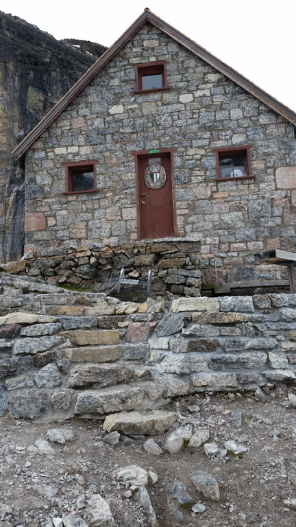
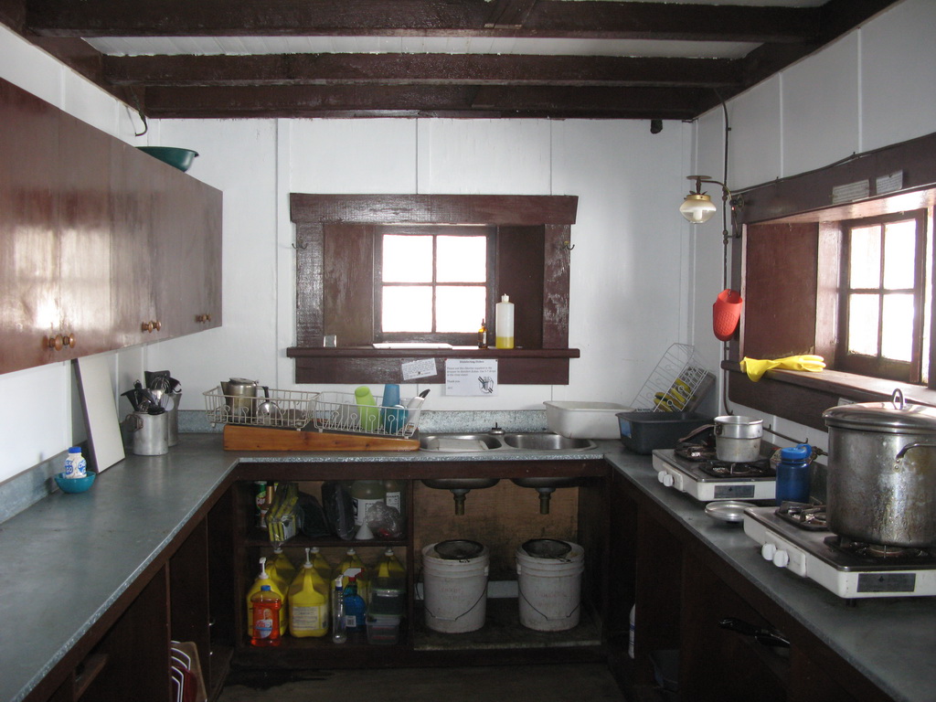
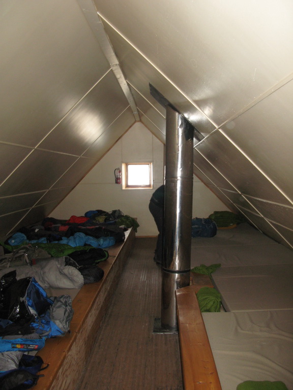
The hut is very comfortable inside. The kitchen is fully equipped with utensils and has several propane stoves. There are gas lamps and a wooden stove in a common area. The sleeping banks are on the second floor and have foam mattresses.
We planned to climb Mount Victoria on the first day and Mount Lefroy on the second day. The West Face route on Mount Lefroy is clearly visible from the hut. From the hut's climbing log we learned that a guided party bailed from Mount Victoria Southeast Ridge just yesterday because of "bad snow conditions".
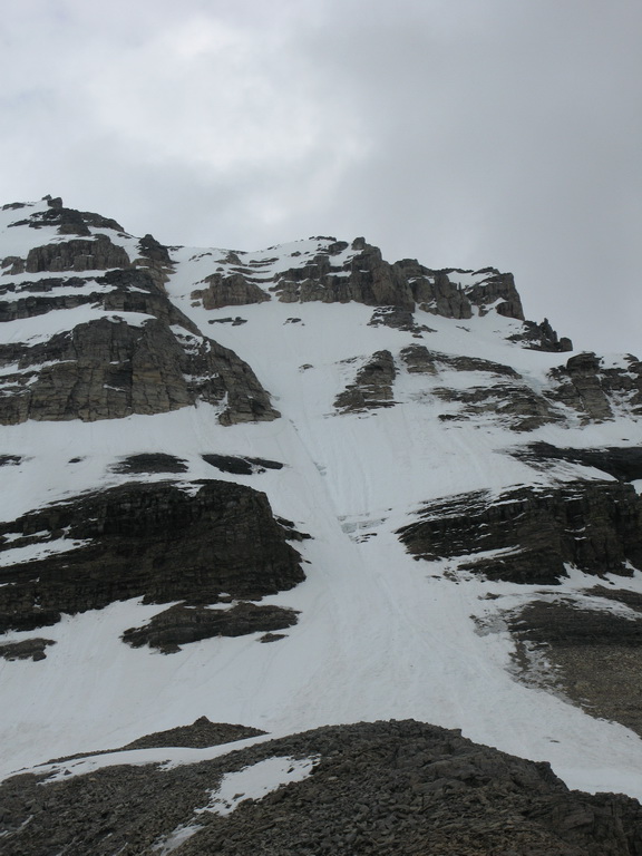
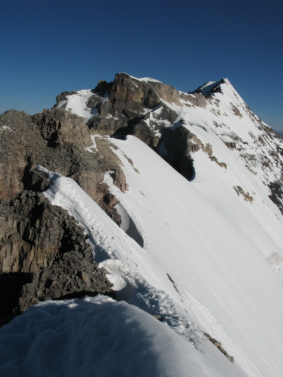
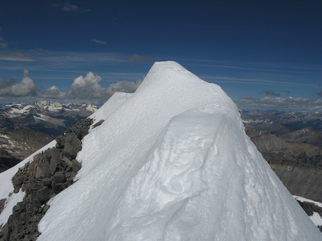
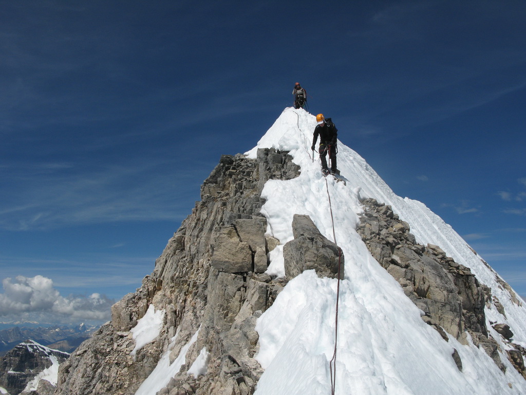
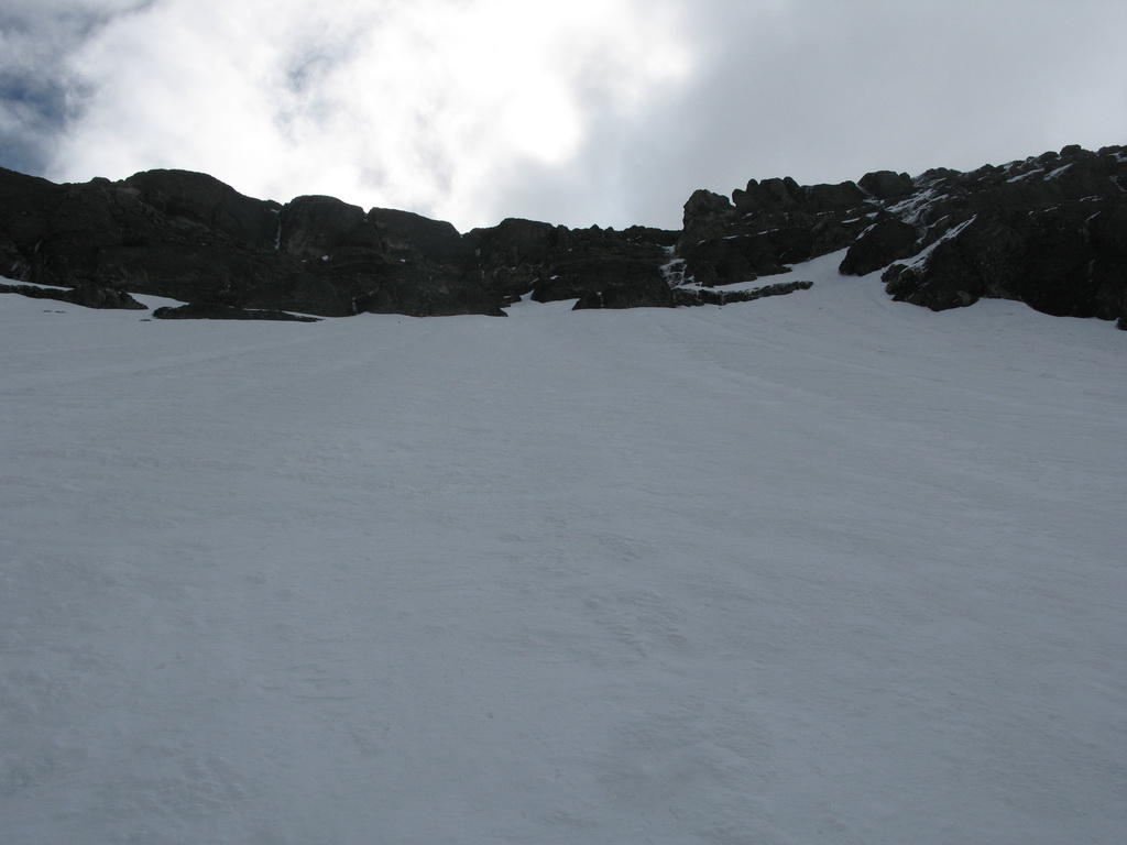
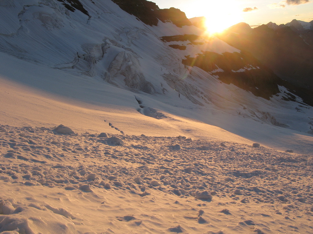
We started from the hut at dawn. Mount Victoria Southeast Ridge is a long ridge - not very technical, but exposed and aesthetic. In general you should follow the line of least resistance tending always to the right – East side to bypass obstacles. We climbed roped for extra safety.

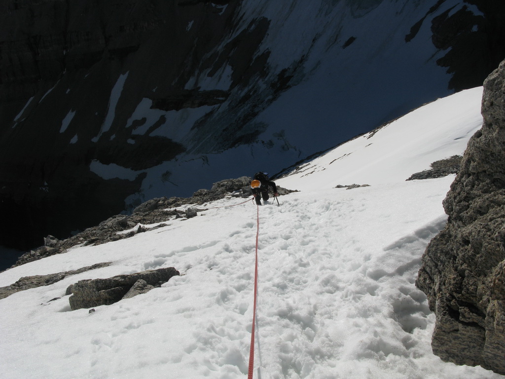
The beginning of the ridge is loose 4th class climbing. Then it follows by snow and rock scramble. It was warm and the snow conditions were bad indeed. On narrow parts of the ridge we started small avalanches from our steps.
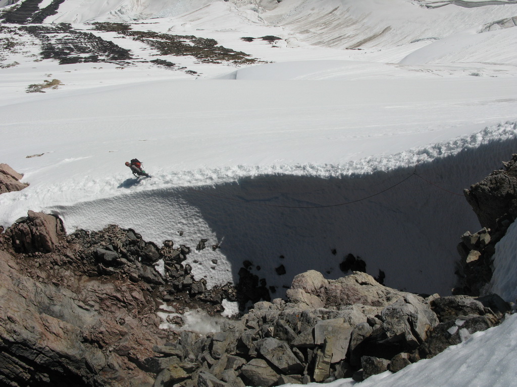
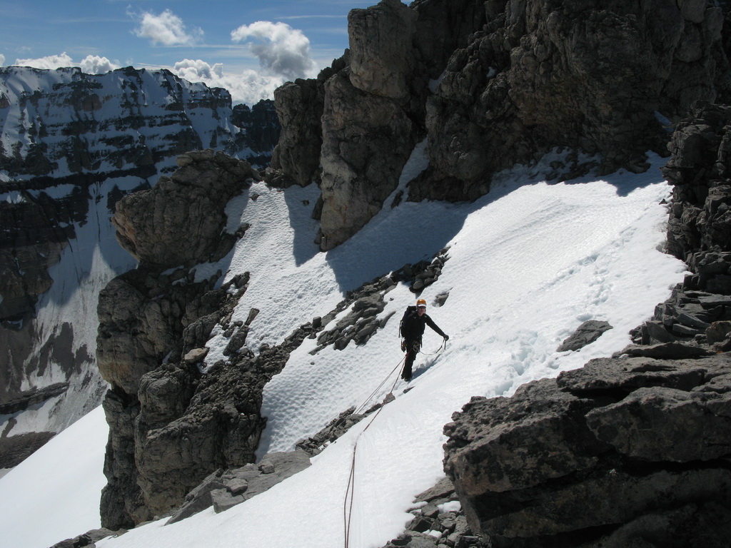
After some time we came to a “sickle” – a drop in a ridge, very narrow. We made a belay on snow pickets. The next challenging part was a rock buttress which we had to bypass on the right side. Because the snow slopes were very unstable, we climbed near the rock wall using rock gear for protection following by short traverse on ice. To regain the ridge we had to climb a snow couloir. The snow stability was a great concern of me and I buried one picket as a deadman.
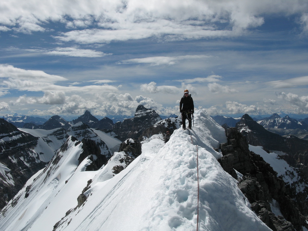
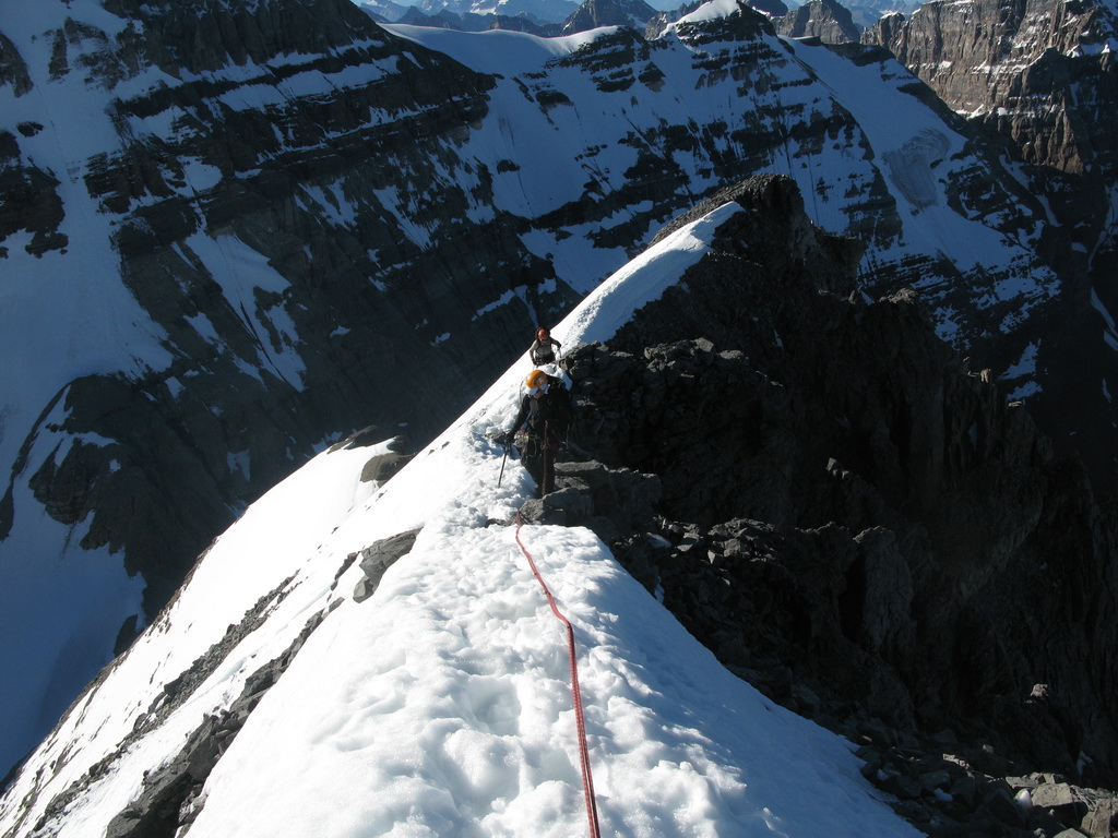
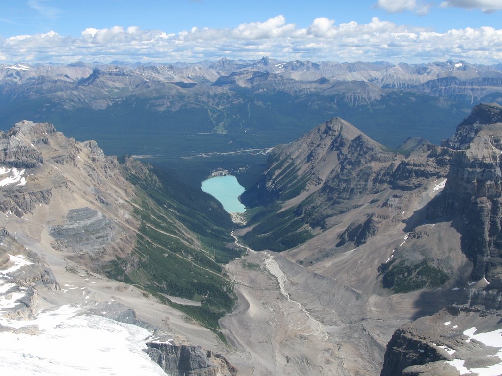
Finally – the summit! The views were amazing. We spent very little time on a summit, because we were afraid that the snow condition will deteriorate even more in the afternoon.
We retracted our way back. We rappelled and belayed the snow couloir, climbed the sickle back, carefully downclimbed the rock section and returned to the hut at dusk.
Out boots were soaked from the day climb in wet snow and we didn’t have time to dry it. Because of that we cancelled Mount Lefroy and descended the next day.
Gear:
- Rope
- Ice axe, technical ice tool each
- 3 ice screws
- Small rock rack
- 3 pickets
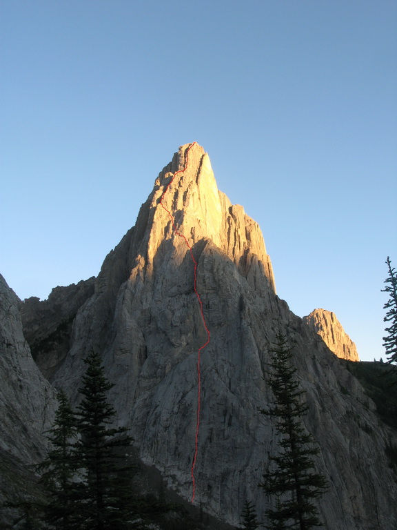
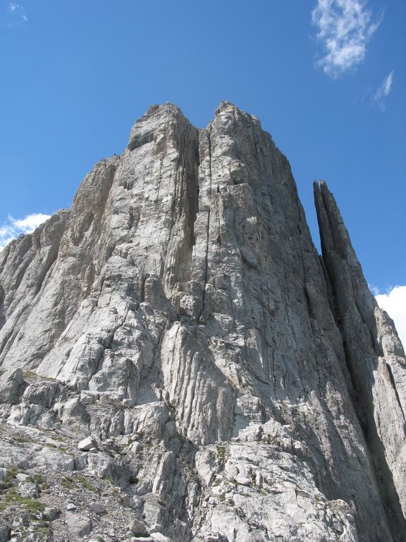
Mount Louis – Gmoser Route. 07/29/2016
Our next objective was Mount Lois – a rocky peak to the east of Banff. The description said the rock quality on Mount Louis is good, which is often not the case in Canadian Rockies. If driving from West, the access road to the Mount Edith Trailhead switches from Highway 1A right before Highway 1A merges with Highway 1. We arrive to the trailhead at dark. The vehicles are not allowed to stay overnight at the parking lot. The approach trail was good and well-marked. At the junction with Gory pass trail we took the right fork towards Mount Edith Pass. We got a first glimpse on Mount Louise at sunrise.
The approach trail breaks somewhere before the end of the forest and the right fork bypasses Mount Edith on open slopes.
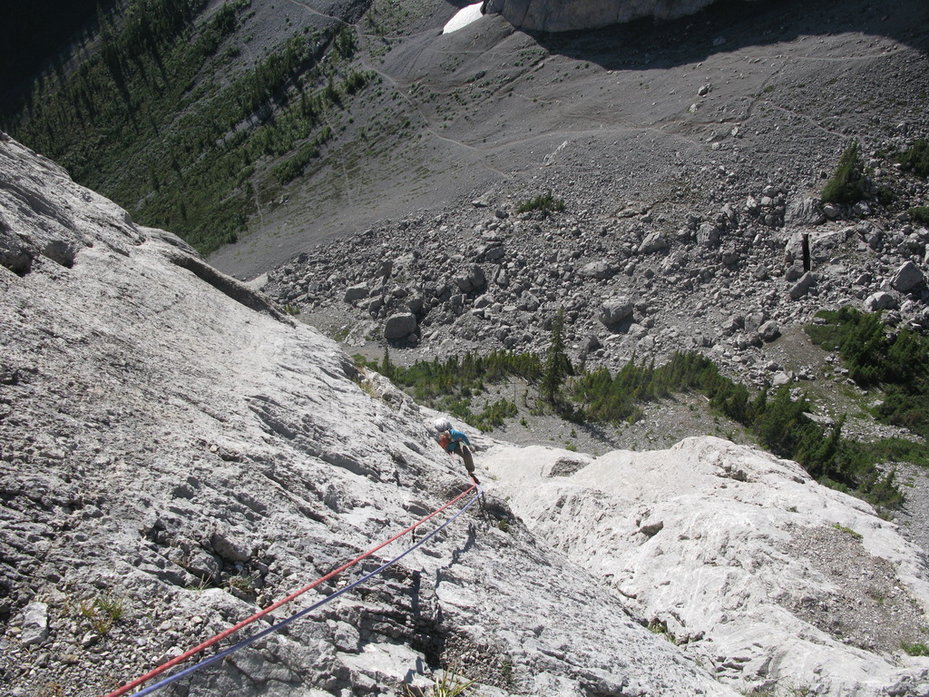
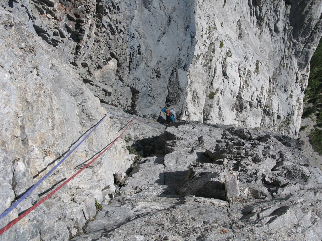
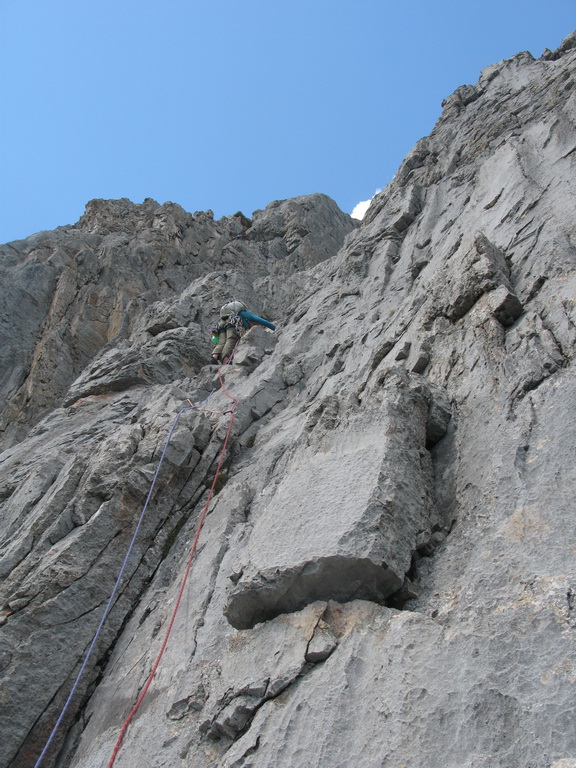
When we came to the South wall, there was already one party on the route. The description of the route on https://www.mountainproject.com/v/the-gmoser-route/110824101 is pretty much precise and I don’t have to add much more from myself. I lead pitches 1-8 and Lyuda took pitches 9-15. For me the lower pitches 1 to 4 as well as pitch 6 were too much enjoyable. While the rock quality was Ok and the climbing was not difficult, the protection was scarce and there were some runouts – not the type of climbing I like.
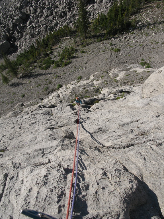
Crux pitch 5 on the other hand was pretty good with excellent stemming. In the middle of a pitch there is an awkward move to a small alcove which delayed me for a bit. You can find protection everywhere on a pitch. At some point after the crux pitch you can see a sling above you. This is a rappel section from Kain route – don’t go there, move left instead.
Upper pitches, starting from pitch 7 were more interesting. We climbed Perren Crack as most people do now.
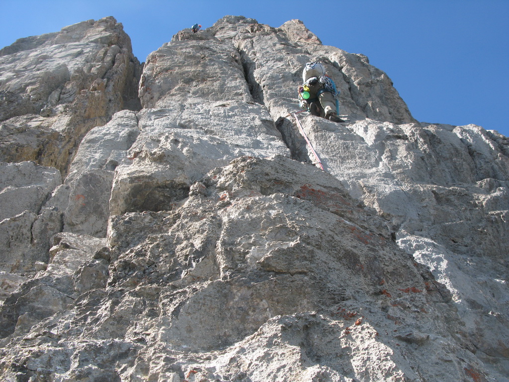
We spent some time on a summit, having lunch and enjoying a sea of limestone peaks around us.
Descend from Mount Louise is complicated. We mostly used a description from "Selected Alpine Climbs" from Sean Dougherty. I will give just some notes from my memory. We descended on 60m double ropes. The descend gully turns right after a 1-st rappel and its angle lowered. Here I would recommend not to rappel through a turn, but to stop, find a station (there is one) and make another rappel. I made a mistake rappelling for the whole rope length and the rope became stuck when pulling it through a turn. Next, as precisely described in the guidebook, you will see a "scree bowl" above a steep wall. You should not go there, but climb up and right (facing out) for 10 m into a notch and continue rappels from there. We rappelled to the base of the West Face without incidents – thanks Lyuda and her route-finding skills. From there we descended steep scree slopes around the mountain back to our backpacks. We hiked back at dusk and returned to the car at dark, right when rangers came to inspect our vehicle.
Mount Athabasca – North Face. 08/01/2016
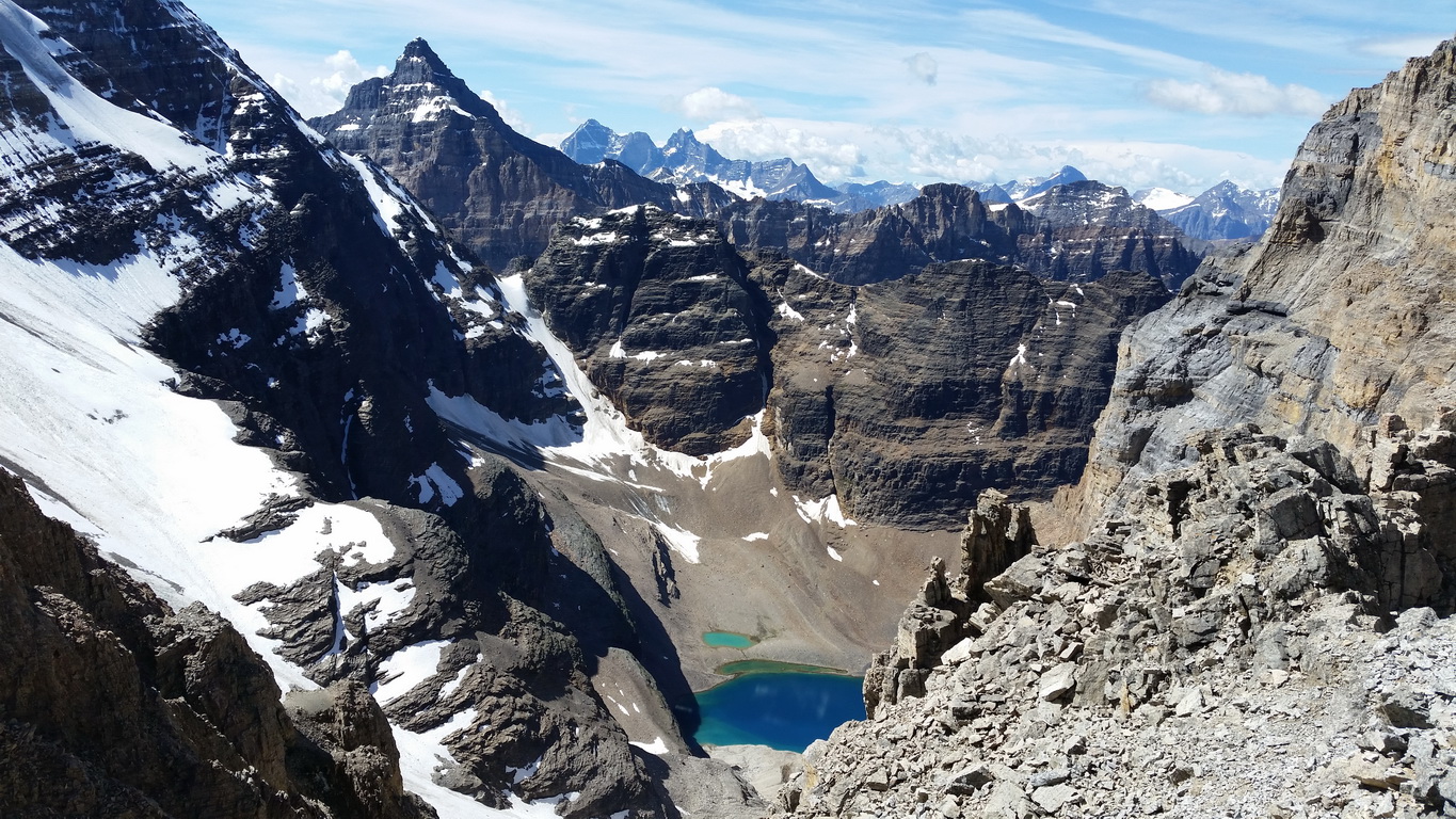
Originally we planned to climb both Mount Athabasca North Face and Mount Andromeda Skyladder route. However, when we watched Skyladder through binocular, it looked like that the lower part of it was melted. I am not sure if it was too late in a season or a permanent change. Mount Athabasca North Face on the other hand looked Ok, so we decide to try it.
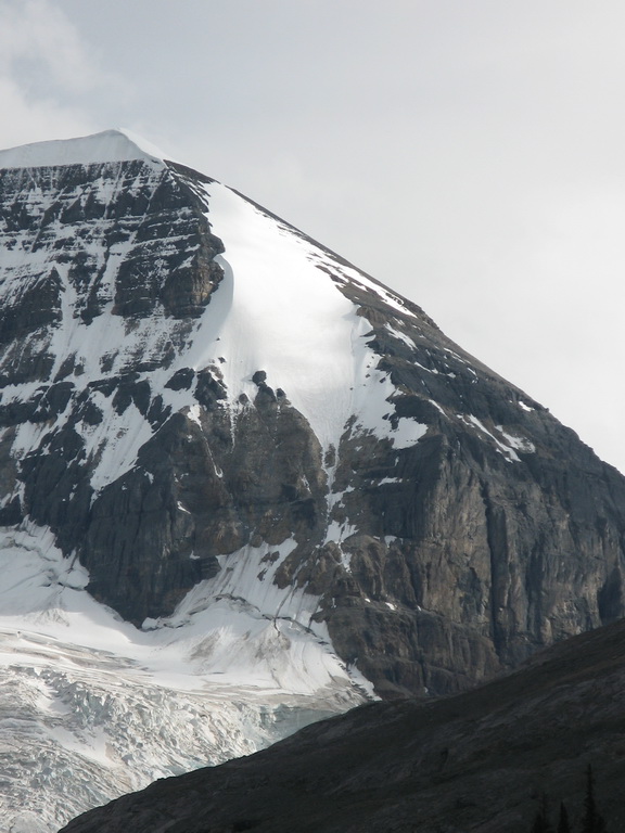
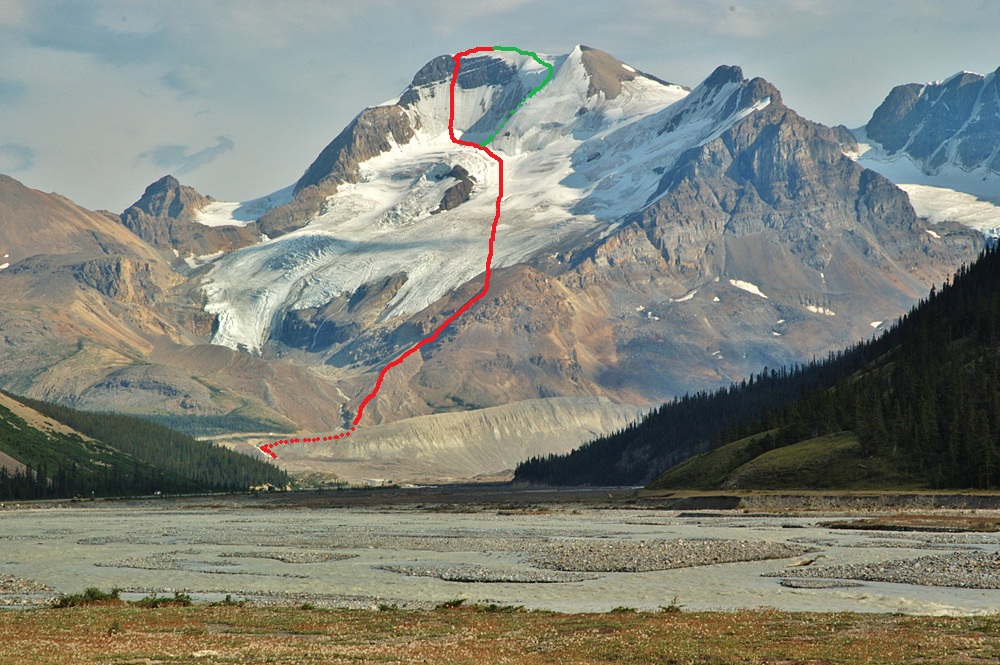
We spent a night at Wilcox Campground, 2.7 km south of the Columbia Icefield Centre on Highway 93. The campground is first-come, first serve and there were some places available. We started at dark and drove to the Icefield Centre and to the Snocoaches road. The guidebooks say the road’s 1st gate is open at night, but it was closed. We parked before the gate and hiked the road looking for the 2nd gate. There was none. We passed some road widening with lights and spare bus tires and hiked further, but soon realized that we are heading on a Snocoaches road towards Andromeda. We returned to the widening and began looking for the beginning of the trail in the dark. We didn’t find any trail and started ascending a moraine close to a stream flow. Here we made some approach mistake. We should follow the stream from the climbers' right side, but we ascended a moraine from its left side. When we realized this, we had to cross the stream to regain the right moraine. When morning light came, we found a climbers trail and followed it towards the North glacier.
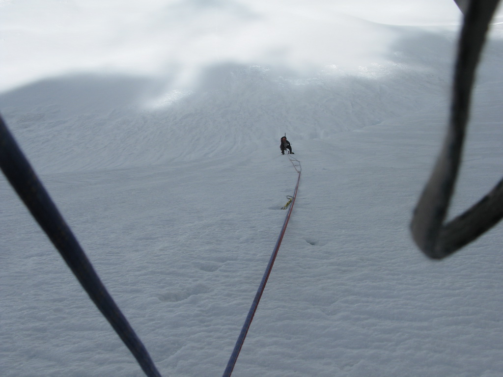
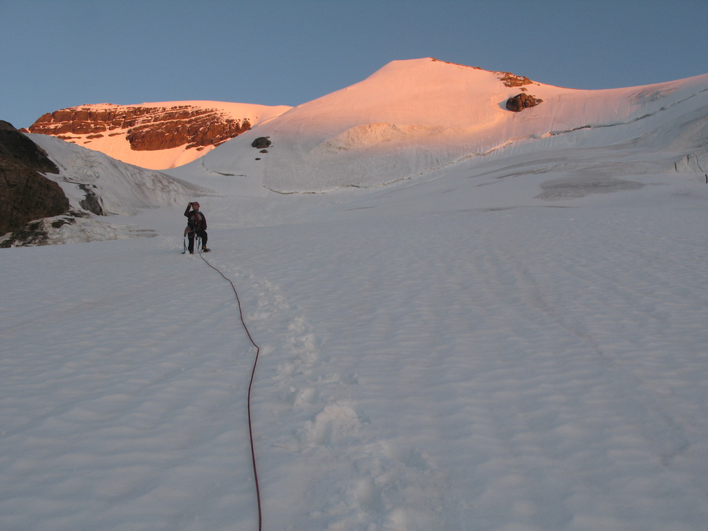
At the glacier we stopped and roped up. We started glacier traverse heading slightly up and left towards the North Face. The crevasses were not really wide compared to Rainier and not too much of our concern. We passed below Silverhorn route with hanging glacier and reached our North Face.
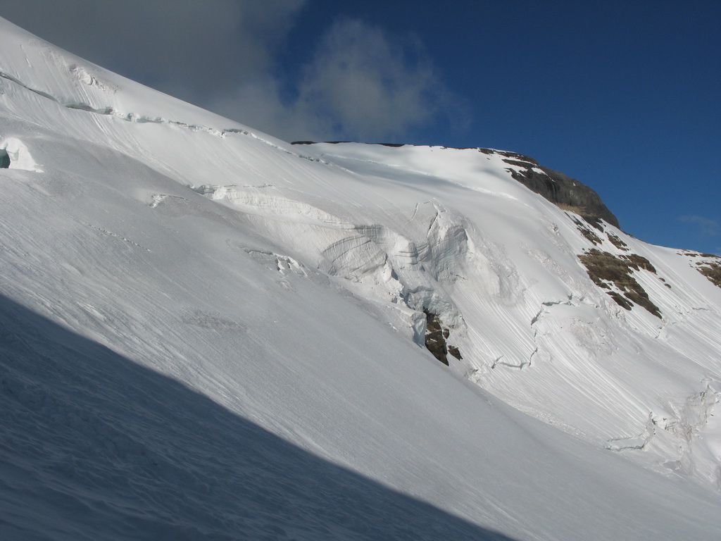
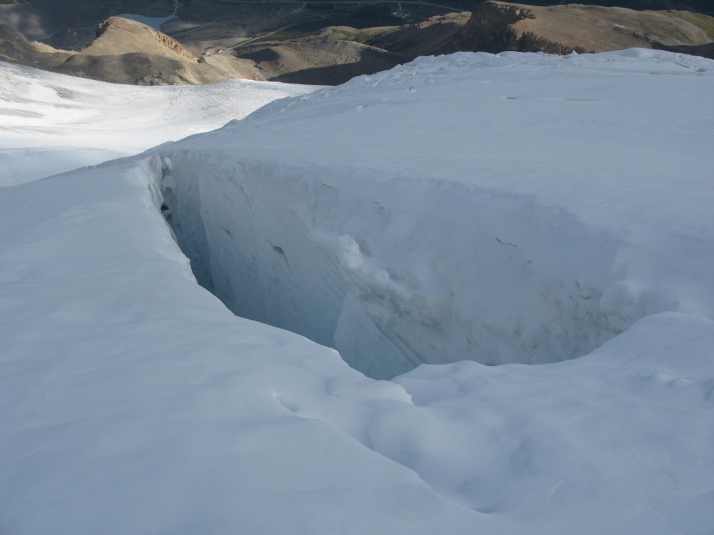
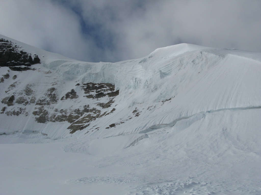
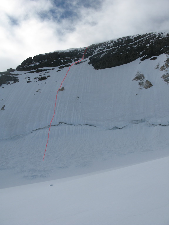
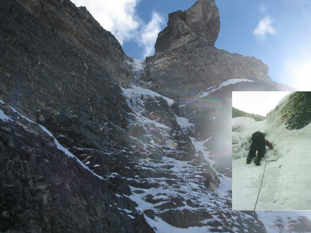
Rock’n roll! First pitch climbed the bergshund with some interesting moves. After the bergshrund the whole line was almost pure ice with some occasional snow cover. We climbed four more pitches, bypassing the yellow rock in the middle of the wall from left.
Then we came to a mixed pitch – the crux. The beginning looked dry with some snow or ice in the right corner. I started climbing on very loose shale. The climbing was not hard, but loose rock and lack of protection made my progress slow. I managed to put 2 pins. When I gained the corner, there was some snow in it and I was able to engage my tools a little bit. After some more of such climbing I found a good crack on right and put a bomber cam in it. I sighed with relief and moved further and found a fixed pin. The exit section was a short steep wall with some stemming, but my tools scratched through the snow above without solid purchase. I made an insecure move and fell. Fortunately, the fall was short and my 2 pieces of rock protection held me. I re-climbed the exit wall more accurately and made a belay.
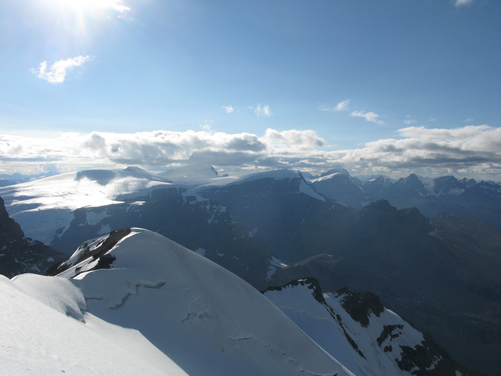
The last 7th pitch was ice gully and Lyuda took the lead on it. Finally – the summit ridge! The views on the Icefields were fantastic in the afternoon sun.
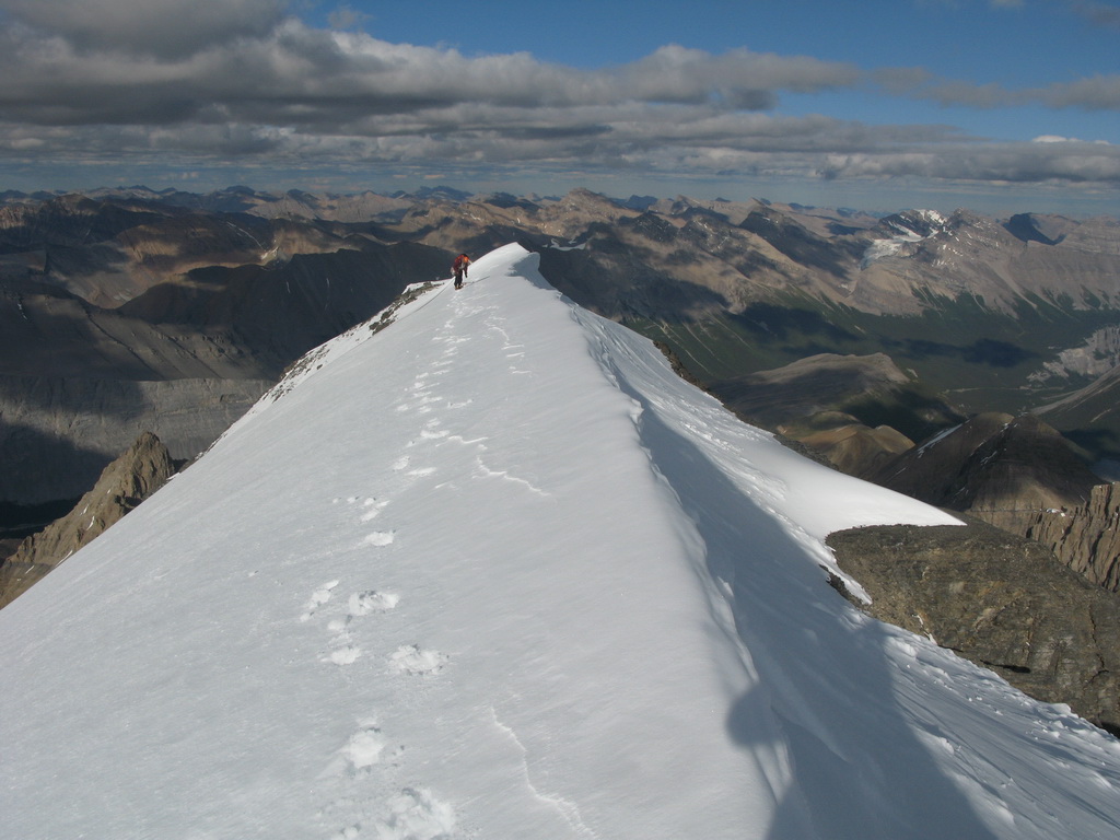
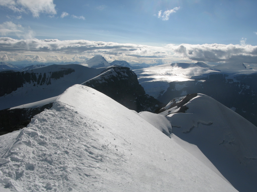
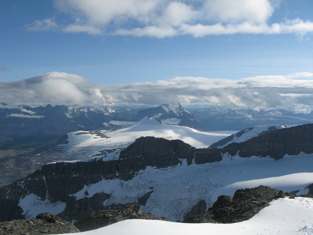
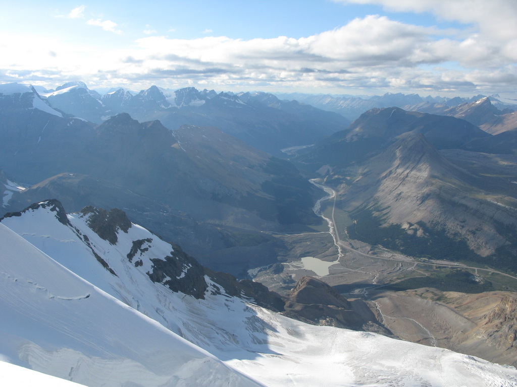
We started climbing the ridge westwards towards Silverhorn. There are 2 descend options from mount Athabasca. One is back to the North glacier - heading right and another one is to AA glacier - heading left. We decided to go down back to North glacier. The snow was very soft and we post-holed slowly, bypassing crevasses.
We descended from the glacier at dusk. The place where we left the glacier looked slightly different from where we started from. Retroactively thinking, we should put a waypoint on our GPS, but we didn’t. For some time we were wandering on the moraine in the coming dark and looking for a trail. Then we found some faint trail which was correct and lead us down through moraines back to Snocoaches road.
Gear:
- 2 60 m half ropes
- 2 technical ice tools each
- 10 ice screws
- Slings
- 2 pickets
- Small rock rack, including pitons
Literature:
- Bill Colbert. The 11000ers of the Canadian Rockies
- Sean Dougherty. Selected alpine Climbs
Useful website:
https://stevensong.com/